The whole parcel on one screen
Owner and mailing address, the sales on record, the county's values, use, acres, buildings and zoning, with the parcel outlined on the map.
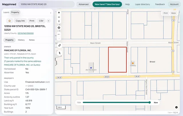
Type an address and read the property: the owner, sales, values and zoning, the flood zones and aerials around it, and the company behind the owner. Your notes stay on the parcel.
Start your 7-day free trial7 days free, then $47 a month. A card starts the trial and is first charged on day 8. Cancel from your account before then and you pay nothing.
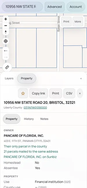
Owner and mailing address, the sales on record, the county's values, use, acres, buildings and zoning, with the parcel outlined on the map.
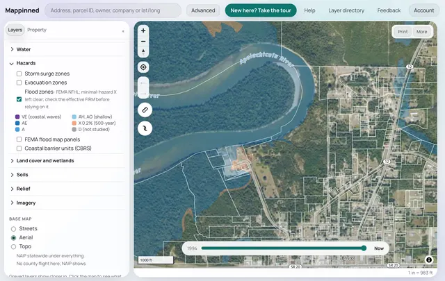
Zoning and future land use, FEMA flood zones, wetlands, soils, contours, storm surge, traffic counts, and aerial photos back to 1938 where they were flown.
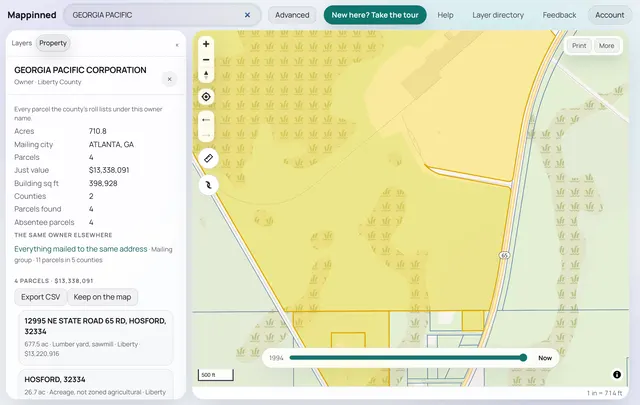
Every parcel one owner holds, across counties, and for a company its Sunbiz filing: the officers, the registered agent and the other companies they run.
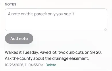
Write what you saw on the parcel itself, star the ones you are watching, and pull them up from your phone's browser. Nothing to install.
$47 a month
After 7 free days. Cancel any time from your account.
Start your 7-day free trialAll 67 counties: every parcel on each county's property roll, with its outline on the map.
Public records only: the county property appraisers' rolls and sales, the Florida Department of Revenue, the Division of Corporations (Sunbiz), FEMA, the U.S. Census and other public agencies. Each layer names its source on the map.
No. Mappinned is property data: parcels, owners, companies and the public layers around them. No skip tracing, no phone numbers, no emails.
Create an account with your email and mobile, add a card, and use everything for 7 days. Unless you cancel, the card is charged $47 on day 8 and each month after. Cancel any time from your account.
Yes, in your phone's browser. The map fills the screen and the parcel opens in a sheet you swipe up.
Each county's roll as the county last published it; a parcel's report says which roll year it shows. The data is as the public records have it, so check anything that matters with the county.